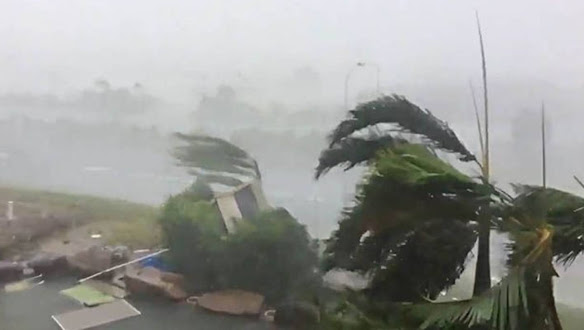
Weather: Mocha Is 3rd Super Cyclone On Record In Indian Seas Since Year 2000
Super Cyclone 'Mocha' will go on record to be the most powerful tropical storm in the Indian seas since the year 2000. Though the weather agency kept the intensity limited to 'Extremely Severe Cyclonic Storm', Joint Typhoon Warning Centre at Hawaii upgraded the storm equivalent to a Cat-V hurricane for a few hours between the 13th May late night and 14th May morning.
Cyclone Mocha was monster of a storm
According to Skymet Weather, Cyclone Mocha was the monster of a storm and had all the ingredients of intensification to the topmost category. The heat potential remained constantly high with ocean surface temperature hovering 31-32 degrees, the highest anywhere around the globe at this time.
Apparently, cyclone Mocha is the 3rd Super Cyclone on record in the Indian seas since the year 2000. Before this, super cyclone Amphan struck West Bengal (Bakkhali) on 20th May 2020 with a peak wind speed of 240km/hr. Another super cyclone 'Gonu' developed over the Arabian Sea and made landfall over Oman in June 2007 capturing the highest wind speed of 240km/hr.
The strongest cyclone in the Indian seas so far, in recent history was the 'Odisha Super Cyclone" ( Oct 25-Nov 03, 1999) achieving a peak wind speed of 260km/hr.
Cat-V hurricane has a wind field of 252km/hr or more. Even a Cat-IV hurricane having wind speed in the range of 209-251 km/hr can be rated as a 'Super Cyclone' when the wind speed breach 222km/hr.
Super Cyclone Mocha which crashed into the Myanmar coast on Sunday, 14th May 2023 at a peak intensity of 260 kmph becomes the strongest storm of this century in the Indian seas and equals a terrific record of 'Odisha Cyclone', way back in 1999.
Remnants of Mocha to give rains over Northeast India
The northeastern parts of the country have seen some rains in the last 24 hours including Imphal at 21 mm, Silchar at 21 mm, Haflong at 11 mm, Lumding at 5 mm, and Golaghat at 4 mm. These rains have been in view of Cyclone Mocha which crossed the Myanmar coast Sunday.
The system has weakened into a depression and will weaken in a well-marked low and thereafter in a low-pressure area by Monday night. The system is dragging moisture towards itself due to which rains will continue over the region.
Tripura and Mizoram along with Meghalaya will be the ones seeing the most rain in the next few days, for about one week. No damaging effect expected but continuous rains may give rise to landslides etc. due to the terrain.

